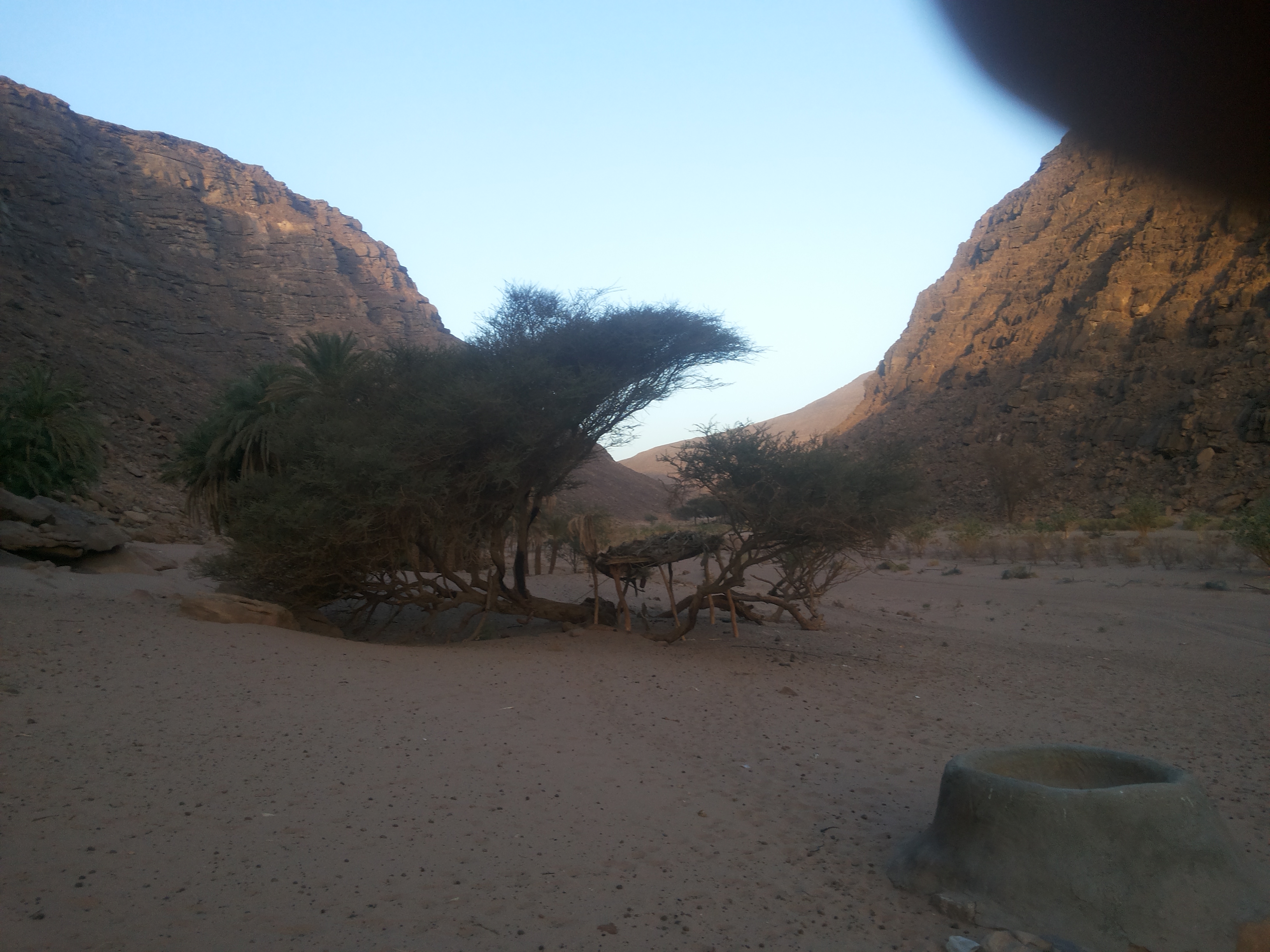
| Coordinates | 23.1323, 35.5909 |
|---|---|
| Category | City, Planning, Culture |
| Nearest city | Regional hub - biggest city in its area |
| Region | Red Sea, Egypt |
| Sources | geonames |
Shalateen Travel Guide: Best Things to Do
Shalateen is a city in Red Sea, Egypt, home to about 12,443 residents. This guide covers how to visit it, what to expect and how to build a day around it.
Shalateen at a Glance
- What it is: city (City)
- Where it is: Red Sea, Red Sea, Egypt — coordinates 23.1323, 35.5909
- Why it is listed: a source-verified entry in the CollabsTravel master database, matched against official gazetteer and geographic records before publication
- Time needed: one full day
- Best season: April-May and September-October for mild days and thinner crowds
Quick Facts
| Place type | City |
| Primary category | City |
| Also good for | Planning, Culture |
| Region / state | Red Sea |
| Country | Egypt |
| Population | 12,443 |
| Coordinates | 23.1323, 35.5909 |
Why Shalateen Is Worth Visiting
Shalateen earns its place in this guide for a simple reason: it is a verified city in Red Sea, Egypt, at about 12,443 residents it keeps the scale travellers usually mean when they say they want somewhere off the beaten path. With 8 other verified places within 150 km, it anchors a cluster instead of standing alone. Visitors book it for planning, culture as much as for city. And unlike listicle recommendations, everything on this page - coordinates, category, sources - was checked against official records before publication.
About Shalateen
In plain terms, Shalateen is a city in the Red Sea area of Red Sea, Egypt that travellers book around city trips. It is a settled place of about 12,443 people, which means shops, fuel and basic services exist locally rather than only in the next county. Beyond its main draw, the record tags it for planning, culture too, so it rewards more than one kind of visit. Everything stated on this page comes from that verified record; where background history is quoted, the source is named at the end of the section.
The Story of Shalateen: History & Background
Shalateen (Arabic: شلاتين Šalatayn, Egyptian Arabic: ; also spelled Shalatin and Shalatayn) is the biggest town in the Halaib Triangle, a disputed territory claimed by Egypt. It is 520 km (320 mi) south of Hurghada and is controlled as the administrative center (markaz) of all Egyptian territory up to the border between Egypt and Sudan, including the villages of:
Abu Ramad, 125 km (78 mi) to the southeast;
Halaib, 165 km (103 mi) to the southeast;
Ras Hadarba 200 km (120 mi) to the southeast. Ras Hadarba or Cape Hadarba lies on the shores of the Red Sea to the southeast of the city of Halayib and to the east of mount Hadarba from which it takes its name. The village of Ras Hadarba lies just north of the borders between Egypt and the Sudan which run along the 22 degree north parallel of latitude;
Marsa Hameera, 40 km (25 mi) to the north; and
Abrak, 90 km (56 mi) to the west.
The first three of the above towns (Abu Ramad, Halayib and Ras Hadarba) are located within the disputed Hala'ib Triangle.
The population of Shalateen is estimated at 23,554 people and is inhabited by the Bisharin (Al Bishareya) and Ababda (Al Ababda) sub tribes of the Beja people.
Lead passage from the Wikipedia article "Shalateen", reused under CC BY-SA 4.0 with a coordinate-verified name match; the source article carries the full referenced history.
The Beauty of Shalateen
What people mean when they call Shalateen beautiful is usually street life: main-street architecture, local signage and the evening rhythm that makes a town photogenic rather than just populated. The light does most of the work: low-latitude light keeps greens deep and skies dramatic; the difference between hours, not seasons, drives the look. The seasons restyle everything around it - stone and brick hold their colour year-round; what changes is crowd density and the angle of light down the main streets. And the beauty compounds with context: with 8 other verified places nearby, the Red Sea area reads as one continuous landscape rather than a single viewpoint, which is worth more than any filter on the photos you take here.
Getting There
Shalateen sits at 23.1323, 35.5909 in Red Sea, Egypt. Most visitors reach it by car, regional rail or local transit; pin the coordinates above rather than only the name - Shalateen names repeat across regions, and rural entries often lack street addresses.
Best Time to Visit
Late spring to early autumn (May to September) brings the warmest and most reliable conditions across Egypt. Shoulder months just before and after that window trade a little weather for noticeably lower prices and thinner crowds.
Shalateen Season by Season
- Summer (Jun-Aug) - peak season: the warmest, longest days and everything open, which also makes it the priciest and busiest window
- Autumn (Sep-Nov) - shoulder season: crowds drain away, the light turns photographic, and lodging rates typically fall
- Winter (Dec-Feb) - off-season: cheapest beds and empty viewpoints, but check for closures, snow or rain before committing
- Spring (Mar-May) - rebuild season: wildflowers, newborn wildlife and reopened facilities - the best balance if the weather holds
Things to Do
Planning what to actually do at Shalateen comes down to the setting it sits in:
- Arrive with the exact coordinates (23.1323, 35.5909) pinned in your maps app — rural place names repeat across states
- Cluster the old downtown/core district on foot and save the car for outlying attractions
- Check the city's event calendar the week before — festivals redefine parking and hotel rates
- Look for the free walking-tour or visitor centre as the fastest orientation
- Chain the stop with what is nearby — see the list below before fixing your day route
None of this needs a rigid schedule - the honest pattern at Shalateen is one anchor at the historic core or main square, one longer stop, and the rest of the time left for whatever looks better from the car window. That flexibility is what separates a good half-day from a rushed one.
A Perfect Day in Shalateen
Morning (start early). Have breakfast at Shalateen and roll out before mid-morning - the light is softer, parking is open, and Shalateen is at its quietest before the day-trippers arrive. Give the main stop its full due first rather than saving it for later.
Midday. From Shalateen, Shalātīn is only 1 km away - pair the two rather than driving home for lunch; a picnic beats a reservation near most of these spots.
Afternoon. Keep going to Jabal Sarīr (24 km) if the group still has legs; it is the standard second half of this loop.
Golden hour. End at the main viewpoint, waterfront or main street as the light drops; this is the hour Shalateen is genuinely famous for locally, and it costs nothing.
Evening. Sleep at Shalateen unless the road out is long - leaving at dusk is the one mistake that can flatten an otherwise perfect day.
Know Before You Go to Shalateen
- Save the pin (23.1323, 35.5909) offline - reception in Red Sea is exactly as good as it needs to be and no better
- Check the official source listed at the bottom of this page for current hours, fees and closures before driving out
- Weekend events and holidays reshape parking and opening hours; scan the local calendar
- Peak-season ticket slots sell out - reserve timed entry if one exists
- Urban scale changes the game: transit passes beat car rentals inside the centre
Nearby Places Worth Combining
Shalateen does not sit in isolation - these verified places are all within a short hop and combine into a full loop:
- Shalātīn — city, about 1 km (1 mi) away
- Jabal Sarīr — hiking, about 24 km (15 mi) away
- Jabal al Anbaţ — hiking, about 27 km (17 mi) away
- Jabal al Farāyid — hiking, about 28 km (17 mi) away
- Jabal Bayḑah — hiking, about 35 km (21 mi) away
- Jabal al Ma‘rafāy — hiking, about 35 km (22 mi) away
- Jabal Umm Tinaydib — hiking, about 46 km (28 mi) away
- Jabal al Būdkin — hiking, about 46 km (29 mi) away
Planning More of Your Trip
See everything in Egypt on the Egypt country hub, browse the full City Egypt collection, or take in the whole Red Sea region.
Frequently Asked Questions
Is Shalateen worth visiting?+
Yes, if you are in the area for more than a single day. Shalateen is a verified city in Red Sea, Egypt that most drive-by lists miss, and the official-record provenance behind this page means the location, name and access facts are checked rather than guessed. Give it one full day.
Where exactly is Shalateen?+
Shalateen is in Red Sea, Egypt, at coordinates 23.1323, 35.5909. Use the coordinates rather than the name alone - place names repeat across regions, and a map pin beats a keyword search.
How far is Shalateen from the nearest city?+
The nearest named base on this guide is close enough that distance is not the constraint; the Quick Facts table lists the exact road-town km, and every place here is reachable as a same-day loop from a regional hub.
What is the best time to visit Shalateen?+
April-May and September-October for mild days and thinner crowds. Book the shoulder months either side of that window for the same scenery at lower prices, and check seasonal closures before fixing dates.
How long do you need at Shalateen?+
Plan on one full day for a first visit - the highlights at a normal pace without rushing. Add another half day if you want to combine it with the nearby places listed above.
Is Shalateen good for families with kids?+
Yes - short distances, services nearby and the flexibility to bail after an hour all make Shalateen a realistic family stop. The main kid-risk is over-scheduling: one anchor per day beats three.
Does Shalateen cost anything to visit?+
Walking around Shalateen is free; the museums, attractions and tours that make the visit deeper are paid, and booking timed entry online is almost always cheaper and always faster.
What is near Shalateen?+
The closest verified neighbour is Shalātīn; the nearby list above has the full set with distances, and combining two or three of them is the standard way to fill a day around Shalateen.
Is Shalateen open to visitors, and do you need a permit?+
Public places listed here are visitable by default; the permit exceptions are usually specific activities (backcountry camping, drones, commercial photography) rather than the visit itself. Check the cited official source for anything activity-based.
Should you visit Shalateen in bad weather?+
Rain reshapes rather than ruins the day - viewpoints become cloud-scapes and trails get muddy. Keep Shalateen as a fair-weather item on your trip and swap in the covered alternatives from the regional list when the forecast turns.
What makes Shalateen different from other places like it?+
Its exact combination: a city in Red Sea, Egypt with verified coordinates and, where listed, an official designation. The difference is usually the setting and the access pattern rather than the category label - the facts table on this page shows that specifically.
Can you visit Shalateen as a day trip?+
Yes - at one full day on site, a day loop is realistic: morning at Shalateen, one nearby stop, and home by evening. The Perfect Day section above has the hour-by-hour version.
What is Shalateen known for?+
In the wider record, city-class place: Shalateen (Arabic: شلاتين Šalatayn, Egyptian Arabic: ; also spelled Shalatin and Shalatayn) is the biggest town in the Halaib Triangle, a disputed territory claimed by Egypt. This guide adds the practical layer - verified coordinates, access, seasonality and what to combine it with.
What is the most beautiful thing about Shalateen?+
The honest short answer is in The Beauty of Shalateen section above, but distilled: what people mean when they call shalateen beautiful is usually street life: main-street architecture, local signage and the evening rhythm that makes a town photogenic rather than just populated. Come for the light and the setting rather than a single checklist object.
Is Shalateen crowded?+
Shalateen sits below the headline-name tier in its region, so crowding is an event-and-weekend problem rather than a standing one. Weekday mornings in the shoulder season are the quietest version of the visit.
What is the history of Shalateen?+
The History & Background section above quotes the coordinate-verified Wikipedia lead for Shalateen, which is the shortest trustworthy path into its past - dates, name origin and the events that shaped it, with the full referenced article linked there. ## Source Verification This guide's facts come from official public datasets: [Geonames record 8555994](https://www.geonames.org/8555994). Location data is reviewed in per-state batches before publication.